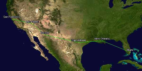
The dynamic scaling engine is up and running. Maps are being properly selected, and, at least at first glance it's VERY fast. I've been adding more functions to clean up the output (full colour selection, the ability to lock the images height to width ratio, etc.). Below is the course (as the bird flies) of this year's Gumball 3000:
Now I'm going to turn on the bots and generate all of the nighttime files as well; one of the first things I'm building is the tracker plugin, so you can display everyone who's recently come to your page. You can also tell it what time zone you're in, and it'll automatically use the night time map if that's when it's being asked.
PS. I am still in need of good non-projected maps. Specifically I'm looking for a map set that includes good high res border overlays, colored countries/states, and so on. There's got to be someone out there who has a mapping tool! Hmmm… Maybe I'll stop at Staples tonight and see if they have anything like that.


Post a Comment